Research and Monitoring
One of the core functions of the Narragansett Bay Research Reserve is to support and conduct high-quality research and monitoring with a focus on the Reserve’s mission to preserve and protect estuarine habitats within Narragansett Bay. The NBNERR Research program seeks to develop and enhance cooperative partnerships and to integrate with other Reserve programs to conduct and disseminate original research in the Reserve throughout coastal Rhode Island. In addition, the Reserve serves as a long-term platform for external scientific research that spans a variety of disciplines.

Research and Monitoring program focuses on:
1) Ecology of salt marshes in the context of climate change and sea level rise.
2) Long-term monitoring of water quality, nutrients, and weather.
3) Supporting visiting researchers to the Reserve.
System Wide Monitoring Program
National Estuarine Research Reserves are living laboratories and ideal sites for research and long-term monitoring. By understanding how estuaries function and change over time, scientists are in a better position to predict how coastal ecosystems will respond to climate change and natural and human-induced disturbances both locally and on a national level.
As part of the national network of reserves, we participate in the System-Wide Monitoring Program (SWMP). This long-term program collects data using standardized instrumentation and protocols across the coordinated network of coastal observing sites for detecting and understanding environmental change.
Abiotic Monitoring
Since 1995, the Reserve has collected near-continuous water quality and meteorological data along with monthly nutrient and chlorophyll data at four stations around Prudence Island. These long-term data sets support decision-making to effectively address coastal resource management issues, scientific research and monitoring around Narragansett Bay, and educational, training and stewardship activities around the Bay.
Real-Time Data
After extensive quality assurance and quality control, SWMP water quality and weather data are available from NOAA-funded Centralized-Data Management Office.
The Real-Time Data Application allows users to view near-real-time water and weather data from any of the Reserves within NERRS. Each Reserve has at least one water quality station and one weather station providing immediate, real-time information. View our real-time water quality data from the T-Wharf and weather data from Potter Cove at the Reserve.
Biological Monitoring
Biological monitoring at the Reserve was initiated by the establishment of a sentinel site on Prudence Island as part of the NERRs Sentinel Site Program. The Reserve’s goal is to gather and analyze in-depth data to study the effects of sea-level change and inundation on tidal wetlands. The results of this research, together with the long-term monitoring data collected, provide a strong, science-based foundation to inform programs, policymakers, and managers in charge of making coastal management decisions.
Mapping Habitat and Land-Use
The Reserve generates maps of coastal and estuarine habitats of Narragansett Bay to track and evaluate how they are changing over time. Changes can occur at broad scales, which in turn can impact habitats, such as the composition of Reserve salt marshes, at the local scale
Collaborative Projects
A National Synthesis of Tidal Marshes to Detect Impacts of Climate Change Across Multiple Scales
Tidal marshes are facing tremendous pressures from climate change, including accelerated rates of sea-level-rise, increased storm activity and precipitation extremes, lengthened growing seasons and shifts in salinity regimes. Recent research within National Estuarine Research Reserve (NERR) sites has revealed striking changes in plant communities that seem to be caused by rising seas, including shifts toward more flood tolerant species, lower overall plant diversity, and in some cases growing swaths of bare ground. This project will leverage the Reserve System’s geographic diversity, nationally coordinated monitoring program, communication networks, and strong record of collaborative research to conduct a groundbreaking national study examining how marsh plant communities are responding to climate change. Learn more
Thin-Layer Sediment Placement: Evaluating an Adaption Strategy to Enhance Coastal Marsh Resilience
Tidal marshes provide key ecosystem services, but are threatened by sea level rise. For these ecosystems to survive, it will require active management to increase tidal marsh resilience. Researchers at the Narragansett Bay and Elkhorn Slough National Estuarine Research Reserves recently led the first national assessment of tidal marsh resilience to sea level rise to monitor coastal reserve sites across the continental United States. In this project, the group took the next step to test a strategy that can enhance tidal marsh resilience. Thin-layer placement (TLP) is an emerging climate adaptation strategy that mimics natural deposition processes in tidal marshes by adding a small amount of sediment on top of marsh in order to maintain elevation relative to sea level rise. It is one of the only viable strategies to protect tidal marshes in their current footprint. Learn more
"Capturing" Wildlife on the Move
Scientists from across the National Estuarine Research Reserve System have conducted the first-ever North American inventory of coastal wetland wildlife. Learn more.

Additional Ecological Monitoring
In addition to the Sentinel Sites salt marsh monitoring component of SWMP, we also conduct other biological monitoring in the Reserve and elsewhere around Narragansett Bay with our partners. Monitoring is diverse in scope and topic, ranging from discrete or short-term surveys of macroalgae and seals to longer-term hierarchal submerged aquatic vegetation (SAV) monitoring and mapping.
Submerged Aquatic Vegetation
Submerged aquatic vegetation (SAV) is an important indicator of ecosystem health and knowing its extent and distribution is important for making informed coastal management decisions. While a full-scale aerial assessment provides the most comprehensive data, it isn’t always possible because of the high cost and time commitment. Therefore, the Reserve uses a rapid assessment approach using underwater video and statistical sampling protocols for efficiently and cost-effectively mapping SAV within Reserve waters.
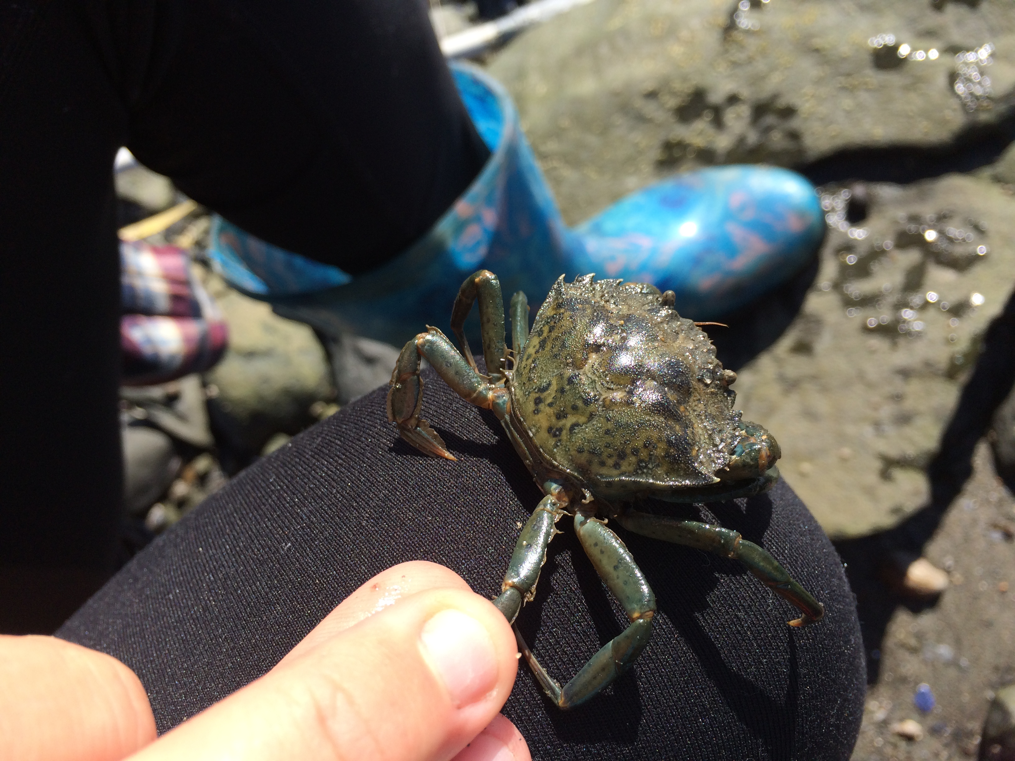
Asian Shore Crab and Cobble Beach Communities
Despite the potentially important ecological and economic effects of invasive species, relatively little research and monitoring has been conducted on these species in Narragansett Bay. This is true for the Asian shore crab, whose suspected distribution and high abundance in Narragansett Bay might have important effects on other estuarine species that live and forage in rocky intertidal habitats.
The goals of this project are to:
1. Quantify the distribution and density of Asian shore crabs throughout Narragansett Bay.
2. Quantify physical factors at each crab sampling site to help explain any observed patterns in crab distribution and abundance.
3. Assess the impact of this invasive crab on intertidal cobble beach communities.
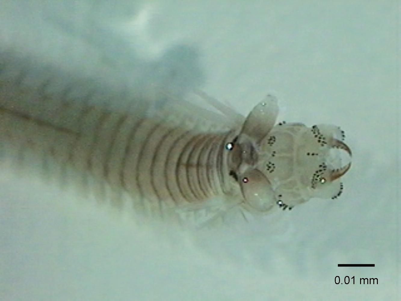
Benthic Infauna
Benthic infauna is also an excellent indicator of eutrophication and ecosystem health, yet these communities are not being monitored over the long term in Narragansett Bay. This program started in 2010 and will provide excellent quantitative data and allow for the assessment of community change over time.

NBNERR is now part of the Motus Tower Network!
The Motus Wildlife Tracking System (Motus) is an international collaborative research network that uses coordinated automated radio telemetry to facilitate research and education on the ecology of migratory animals.
Motus towers detect tiny radio tags on animals flying by, Providing scientists with valuable insights into their migration patterns and conservation needs. Learn more at Motus.org